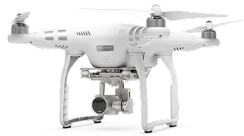
At SkyBrights, we offer advanced drone services that enhance efficiency, accuracy, and safety across a wide range of industries. Whether it’s high-precision inspections, aerial imaging, or 3D mapping, our solutions are designed to support smarter, faster, and more effective operations.
Serving the New York Metropolitan Region, we partner with sectors like construction, real estate, infrastructure, and energy—delivering detailed data from above to help reduce risks, lower costs, and improve decision-making.
With every flight, we bring clarity, confidence, and unmatched precision to your project.


Our drone-powered façade inspections provide high-resolution imagery that captures every detail of a building’s exterior—quickly, safely, and with minimal disruption.
Perfectly suited for compliance with NYC’s Local Law 11, our solution helps building owners, property managers, and engineers meet inspection requirements efficiently while reducing costs and improving safety.
Learn More
Our aerial roof inspections offer a safer, faster, and more cost-effective alternative to traditional methods. Using high-resolution drone imagery, we assess roof conditions, detect damage, identify leaks, and evaluate structural integrity—all without the need for ladders or manual access.
Ideal for New York City’s varied rooftops
Learn More
Our high-precision drone mapping services generate detailed, data-rich 3D models for construction, land surveying, and infrastructure planning. By providing accurate measurements and comprehensive visual data, we help streamline project execution, ensuring greater efficiency and fewer errors.
Learn More
Showcase properties with stunning aerial visuals that highlight unique angles, surrounding landscapes, and architectural features. Our high-definition drone imagery adds a dynamic edge to your marketing, boosts buyer engagement, and enhances virtual tours—making listings stand out in a competitive market.
Learn More
Our drone services provide precise aerial imagery to accurately capture and document incidents. With high-resolution visuals, we help you assess damage, investigate causes, and streamline insurance or compliance processes—offering reliable evidence when you need it most.
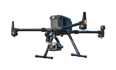
Learn MoreAt SkyBrights, our drone services combines precision, efficiency, and reliability in every mission. With high-resolution imaging, real-time data processing, and automated analytics, we deliver detailed, actionable insights with unmatched clarity
At SkyBrights, our drone services combines precision, efficiency, and reliability in every mission. With high-resolution imaging, real-time data processing, and automated analytics, we deliver detailed, actionable insights with unmatched clarity
Enjoy smooth, uninterrupted performance in any environment, allowing for reliable data collection regardless of location or conditions.
Capture crystal-clear imagery with our high-definition cameras, featuring enhanced zoom capabilities for the finest detail.


Got questions? We’ve got answers. Whether you’re curious about how our technology works or what sets our services apart, explore the most common inquiries about our aerial solutions below.
We specialize in a variety of drone services, including aerial surveying, façade inspection, roof inspection, 3D mapping, thermal scanning, and real estate photography. Our services are designed to enhance accuracy, efficiency, and safety across multiple industries.
Absolutely. We follow all FAA regulations and ensure our drone operators are certified and experienced. Safety is our top priority, and we use the latest technology to maintain compliance and operate within legal and safety guidelines.
The time required depends on the size and complexity of the project. Small-scale inspections may take a few hours, while larger sites like buildings or construction projects may require several days. We always work with our clients to provide a timeline that meets their needs.
Our drone services are used in construction, real estate, energy, infrastructure, architecture, and insurance industries, among others. Whether it’s capturing aerial imagery for marketing or conducting detailed structural inspections, our services are versatile and tailored to meet the needs of each sector.
Our drones are equipped with high-resolution cameras and advanced mapping technology that provide highly accurate data. From 3D models to thermal imaging, we deliver precise measurements and visual information that support smart decision-making.
Yes, our drone inspections are ideal for meeting the requirements of NYC’s Local Law 11, which mandates periodic façade inspections. Our high-resolution imagery and detailed reports make the process more efficient, cost-effective, and safer compared to traditional manual methods.

